How to print topographic maps for free?
Topographic maps are valuable tools for hikers, backpackers, and outdoor enthusiasts who need detailed information about the terrain they’re going to travel through. While printed topographic maps can be purchased from various sources, it is possible to print them for free using online map services or specialized software.
In this guide, we will provide step-by-step instructions on how to print topographic maps for free, including how to access and download topographic data, how to use online map services and software to create custom maps, and what paper to use for printing topographic maps.
We will also answer frequently asked questions about printing topographic maps, such as legal issues and accuracy concerns. Whether you are planning a hiking trip or just interested in exploring the great outdoors, this guide will help you print topographic maps for free to meet your needs.
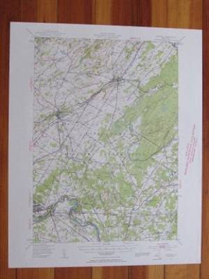
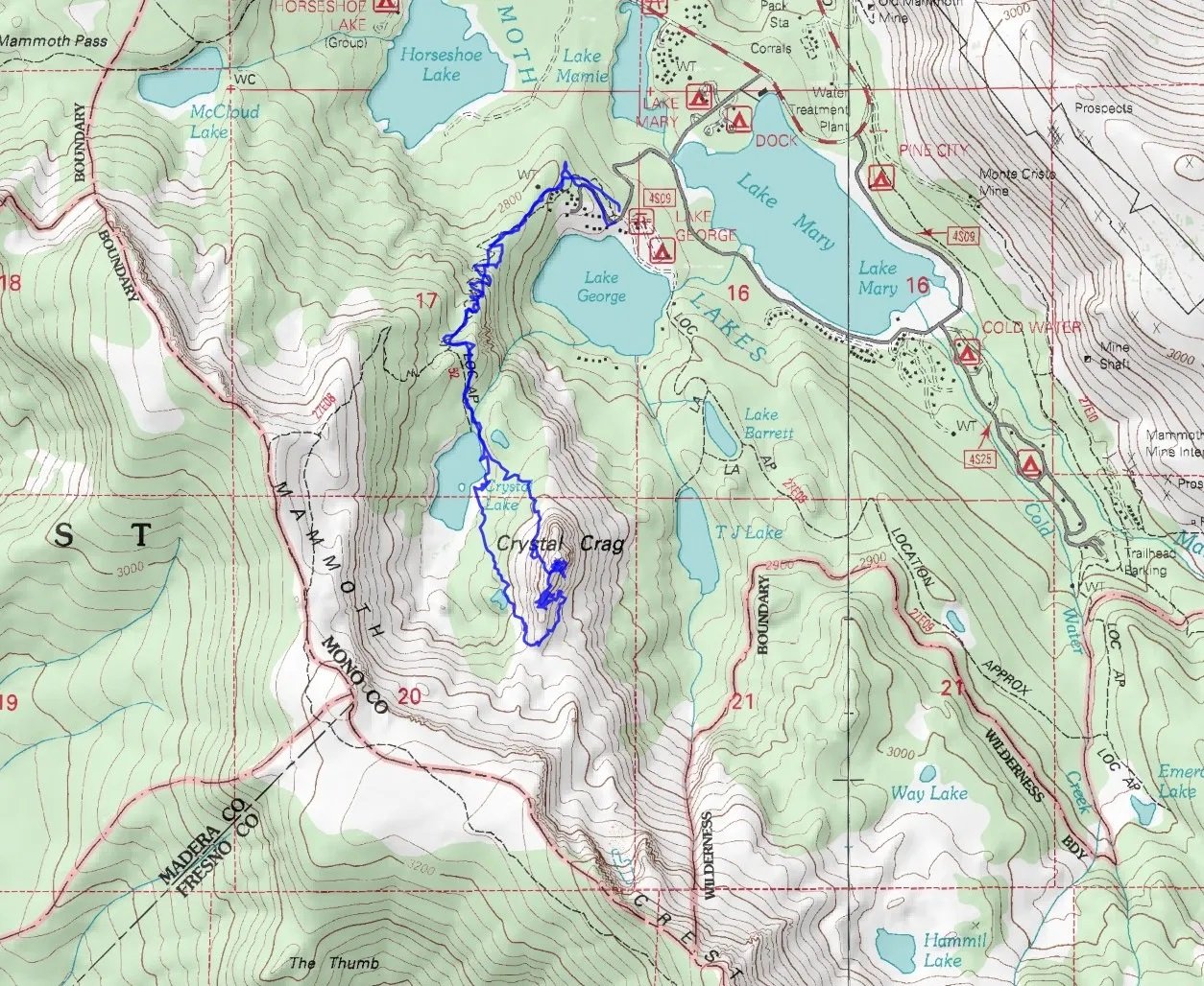
How to Print Topographic Maps for United States?
Printing topographic maps for the United States can be done using a variety of methods, including online map services and specialized software. Here is a step-by-step guide on how to print topographic maps for the United States using some of these methods:
Online Map Services
USGS National Map Viewer: The US Geological Survey (USGS) provides free access to its National Map Viewer, which allows users to view and print topographic maps for the United States. Here’s how to print a topographic map using the National Map Viewer:
- Go to the USGS National Map Viewer website (https://viewer.nationalmap.gov/basic/).
- Select the “Topo” map layer from the “Map Layers” section.
- Zoom in on the area you want to print using the navigation tools.
- Click on the “Print” button located in the top left-hand corner of the screen.
- Adjust the print settings as needed, including paper size and orientation.
- Click the “Create PDF” button to generate the topographic map and save it to your computer.
- Open the PDF file and print it using your preferred printing software.
How to Print Topographic Maps for Europe and the Rest of the World?
Printing topographic maps for Europe and the rest of the world can also be done using a variety of methods, including online map services and specialized software. Here is a step-by-step guide on how to print topographic maps for Europe and the rest of the world using some of these methods:
Online Map Services
Google Maps: Google Maps provides topographic information for most areas around the world. Here’s how to print a topographic map using Google Maps:
- Go to the Google Maps website (https://www.google.com/maps).
- Type in the name or location of the area you want to print a map for.
- Click on the “Satellite” button located in the bottom left-hand corner of the screen.
- Zoom in on the map until you can see the topographic details you need.
- Click on the three dots in the top left-hand corner of the screen and select “Print” from the drop-down menu.
- Adjust the print settings as needed, including paper size and orientation.
- Click the “Print” button to print the topographic map.
OpenStreetMap: OpenStreetMap is a free and open-source online map service that provides topographic information for most areas around the world. Here’s how to print a topographic map using OpenStreetMap:
- Go to the OpenStreetMap website (https://www.openstreetmap.org).
- Type in the name or location of the area you want to print a map for.
- Click on the “Map Key” button located in the bottom right-hand corner of the screen.
- Check the “Hiking” box under “Map Features” to display topographic information.
- Zoom in on the map until you can see the topographic details you need.
- Click on the three dots in the top left-hand corner of the screen and select “Print” from the drop-down menu.
- Adjust the print settings as needed, including paper size and orientation.
- Click the “Print” button to print the topographic map.
Specialized Software
QGIS: QGIS is a free and open-source Geographic Information System (GIS) software that can be used to create custom topographic maps using data from various sources, including satellite imagery, elevation data, and other GIS data. Here’s how to print a topographic map using QGIS:
- Download and install QGIS from the QGIS website (https://qgis.org/en/site/forusers/download.html).
- Import the data you want to use to create your topographic map (e.g. satellite imagery, elevation data, GIS data).
- Create a new map document and add the data layers you want to use.
- Customize the map as desired, including adding labels, legends, and other features.
- Export the map as an image or PDF file.
- Print the exported file using your preferred printing software.
ArcGIS: ArcGIS is a proprietary GIS software that can be used to create custom topographic maps using data from various sources, including satellite imagery, elevation data, and other GIS data. Here’s how to print a topographic map using ArcGIS:
- Download and install ArcGIS from the Esri website (https://www.esri.com/en-us/arcgis/products/arcgis-online/get-started).
- Import the data you want to use to create your topographic map (e.g. satellite imagery, elevation data, GIS data).
- Create a new map document and add the data layers you want to use.
- Customize the map as desired, including adding labels, legends, and other features.
- Export the map as an image or PDF file.
- Print the exported file using your preferred printing software.
In summary, there are several ways to print topographic maps for Europe and the rest of the
What Paper to Use for Printing Topographic Maps?
When printing topographic maps, it is important to use the right paper to ensure that the map is clear, readable, and durable. Here are some options for paper to use for printing topographic maps:
Waterproof Paper
Waterproof paper is a good choice for printing topographic maps that will be used in wet or damp conditions, such as when hiking or camping. Mostly, Waterproof paper is made from synthetic materials that do not absorb water, so the map will remain legible even when wet.
Tear-Resistant Paper
Tear-resistant paper is a durable paper that is resistant to tears and punctures, making it a good choice for printing topographic maps that will be used in rugged terrain or harsh weather conditions.
Photo Paper
Photo paper is a high-quality paper that is designed for printing high-resolution images, such as topographic maps. This paper has a glossy or matte finish that can enhance the clarity and detail of the map.
Coated Paper
Coated paper is a type of paper that has a coating on one or both sides to improve its printability and durability. This paper is often used for printing maps, posters, and other graphics that require high-quality printing.
Conclusion
Printing topographic maps for free is not difficult by using online map services or specialized software. Online map services like Google Maps and OpenStreetMap provide access to topographic information for most areas around the world and allow users to print maps directly from their websites. Specialized software like QGIS and ArcGIS provide more customization options and allow users to create custom topographic maps using data from various sources.
When printing topographic maps, it is important to use the right paper to ensure that the map is clear, readable, and durable. Options for paper include waterproof paper, tear-resistant paper, photo paper, and coated paper.
Frequently Asked Questions
Can I print topographic maps for free without an internet connection?
Yes, you can download topographic data and use specialized software like QGIS to create custom maps offline. However, accessing online map services may provide more up-to-date information and more convenience for many users.
Are there any legal issues with printing topographic maps?
Topographic maps are typically considered public domain information, meaning they can be freely accessed and used by anyone without copyright infringement. However, some maps may be subject to licensing or copyright restrictions, so it is important to check the source and any associated terms of use before printing.
Can I print topographic maps in color?
Yes, most printers can print in color, and many online map services and software programs allow users to customize the color scheme of their topographic maps.
How do I ensure that my printed topographic map is accurate and up-to-date?
Topographic data can change over time due to natural or man-made changes to the landscape. It is important to use the most up-to-date data available and to verify the accuracy of the map by comparing it to other sources or using GPS devices.
Can I print topographic maps for commercial use?
The use of topographic maps for commercial purposes may be subject to licensing or copyright restrictions, so it is important to check the source and any associated terms of use before printing or using the maps for commercial purposes.
See Also…