Do I Need a GPS for Hiking? Benefits, Uses, and Who It’s For
After perusing our various articles on hiking tips and tricks, you may be wondering why we haven’t covered the famous hiking GPS. The answer is quite straightforward – it’s not within its purview (surprise)!
While traditional navigation methods like maps and compasses have long been trusted, the modern hiker is presented with the option of utilizing advanced technology. With quite small and light, the hiking GPS is accurate and efficient and can be very useful for certain categories of users or in certain specific contexts.
In this exploration, we’ll navigate through the considerations, benefits, and potential drawbacks, that help you decide if a hiking GPS is an essential tool for your outdoor pursuits.
Hiking GPS: What Is It?
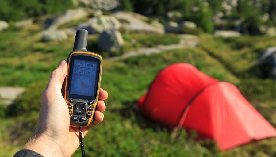
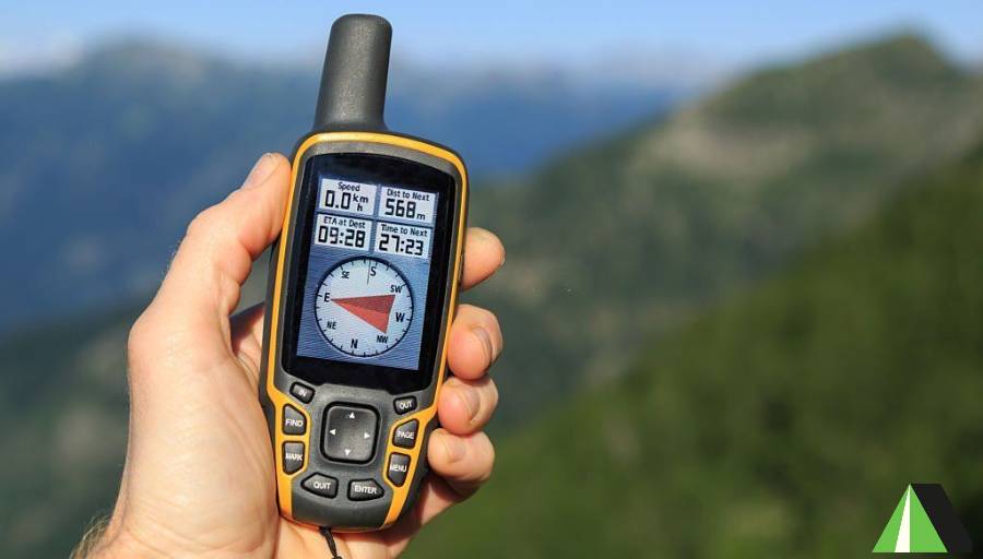
Before we dive into understanding its usefulness and the types of people who can use it, it is necessary to know what is a hiking GPS. Holding in the hand, it comes in the form of a small box. It is manufactured in such a way as to withstand extreme temperatures, high humidity, shocks, and very often a possible fall into the water.
In short, the hiking GPS is an electronic navigation system designed to be taken on all your hikes! Like any navigation system, it connects to American satellites which are used to find one’s bearings in space. Compared to cycling or car GPS, it is quite different when looking at its different functionalities.
The Different Functions of a Hiking GPS
One of the key strengths of a hiking GPS lies in its versatility, offering a range of functionalities. These diverse features make it suitable for various sports and enable precise location tracking. Here’s an in-depth exploration of the functions of a hiking GPS:
Your Live Position
The primary function of such a device revolves around real-time positioning, instantly displaying the device’s location concerning its environment. This feature is exceptionally useful in situations where one is lost or seeking nearby paths, providing immediate and crucial information upon activation.
Note that depending on the model of GPS purchased, you can view your position directly on an IGN map or simply the Lambert coordinates of your situation. There are therefore great differences in use and operation among devices available on the market.
If you want to explore real-world performance and compare dedicated devices, check our detailed review of the Garmin handheld GPS units to see which models work best for serious hikers and outdoor navigation.
Recording of the Route Taken
If you turn it on at the start of the hike, the GPS can remember your entire route. This is one of the interesting features as it allows you to check that you are not going back on your steps! It can also have the advantage of saving a route that you liked or you have just discovered. You can then customize your loops, unearth new paths, or replace certain sections with others.
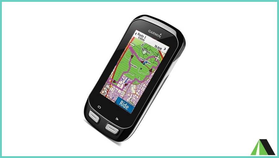
Ability to Follow a Route
Following a route often seems to be the primary function of a car GPS, but this is not necessarily in the case of a hiking GPS. Since the trails are very often marked and the accuracy of navigation systems is around 10 meters, the route function is not necessarily very useful, especially if you have prepared your day’s hike well in advance.
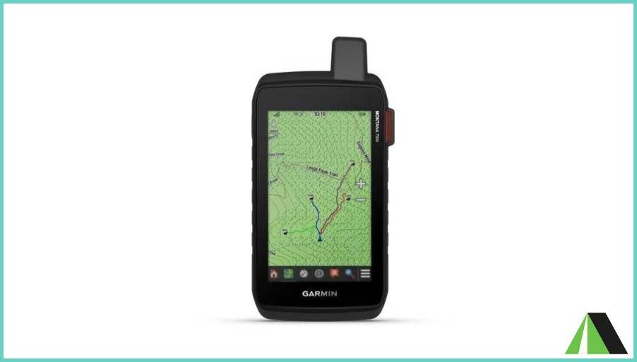
Garmin Montana GPS is now known to have this feature. However, several manufacturers offer the route creation function. From the IGN map digitized in the GPS, you create the itinerary for the next day yourself. When you turn on your GPS on the day of the hike, all you have to do is follow the route that you imagined before.
Compass, Barometer and Altimeter Functions
Thanks to the position of at least 4 satellites, your hiking GPS is quite capable of giving you the direction of north and your altitude at the moment. Be careful though because it is not quite a compass: This is a heading indicator.
In other words, the needle will not point north but will show you the direction in which you are heading. It can be east or south… Also, your pedestrian GPS will give you an unreliable elevation because estimating height is much more difficult to perform than length or width.
Furthermore, the most recent models incorporate a barometer to monitor the atmospheric pressure live. This allows the GPS to warn you when sudden meteorological events are forming (storms, depressions, etc.).
For hikers who prefer a lighter, wearable option, modern GPS watches offer many of the same features. You can explore some of the best GPS hiking watches that combine navigation, fitness tracking, and safety features in one device.
Who Might Need a Hiking GPS?
Every hiker inevitably grapples with the question: Is a hiking GPS superior to a traditional map? Can it be relied on, and are GPS devices suitable for all hikers? In the following discussion, we will endeavor to address these queries comprehensively.
Difficulties in Using the Device
In general, a hiking GPS has the same strengths and weaknesses as any other electronic device. It can be a great tool from the moment you know how to use all its features. However, many hikers can quickly turn away from this device because of its poor ergonomics. Very technical, hiking GPS is not made for everyone. It can be difficult to take in hand for those who are already not comfortable with computers or smartphones.
Therefore, programming a new route requires good knowledge and the insertion of new cards requires knowing the basics of computing. Even when this step is done, it can be abstract to read the maps offered by the different devices because the positions are sometimes indicated in Lambert coordinates.
Sometimes, your position is indicated in degrees of latitude and longitude and it is then necessary to have solid bases in topography or maritime charts to succeed in interpreting this data. The relatively small size of screens, ranging between 2 and 4 inches diagonally, may pose a potential barrier to purchase. Individuals with less-than-optimal near-sightedness may find this aspect particularly challenging and potentially limiting.
A Tool for Specific Needs
Finally, a hiking GPS has no real interest in hikers, even those who leave on a long hike. We have already seen it, but long hikes are very well-marked hiking trails, so they present only a low risk of getting lost. The possession of such a GPS is not necessary.
But then, for what needs and for whom is the hiking GPS useful? It may be of interest to survival or bushcraft enthusiasts. Indeed, to check your route or plan a trail, you will be able to record points of interest such as a water source or a place of shelter.
Skiing or snowshoeing enthusiasts may also need it because the hiking GPS will be the best ally for finding safe paths in the middle of the immaculate white snow. It will help you find a path hidden by the snow several days after your previous passage with an accuracy of between 5 and 10 meters. Also, individuals and athletes, and mountain professionals can then use it.
Although a hiking GPS is a powerful navigation tool, it should always be paired with basic safety essentials. For example, a simple backup like one of these emergency whistles for hiking can be crucial in case of unexpected situations.
FAQs (Frequently Asked Questions)
What is the best hiking GPS?
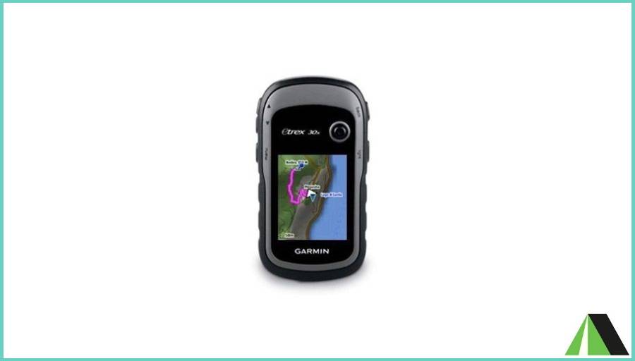
The Garmin eTrex 32x is one of the smallest and lightest pedestrian GPS on the market. It is easy to slip into one of your pockets and its autonomy is dizzying (up to 25 hours in GPS mode with 2 batteries). It combines two satellite systems; GPS and Glonass. You are sure to find your way to where your phone might be lost. Also, it offers a satellite view called BirdEye if you are not comfortable with the topographic map.
Can I use my smartphone instead of a dedicated hiking GPS?
Smartphones can serve as GPS devices, but dedicated hiking GPS units often offer better durability, longer battery life, and specialized features tailored for outdoor activities.
How accurate are hiking GPS devices in remote areas with no cellular signal?
Dedicated hiking GPS units use satellite signals for positioning and are often more reliable than smartphones in remote areas with no cellular signal. For maximize reliability, it’s crucial to ensure your GPS device has updated maps for accurate navigation.
How much does a hiking GPS cost?
On average, it takes between 150 and $300 to get an excellent mid-range hiking GPS. Some models however cost up to $500. Our favorite model, the Garmin eTrex 32x, currently costs around $280.
How to use a hiking GPS?
Develop steps to follow whenever you are at a trailhead. The routine will vary depending on the features of your GPS device, but should include several of the following:
- Acquisition of satellites
- Trip data reset
- Clear Track Log
- Set a landmark at the start of the trail
- Calibrate compass
- Calibrate barometer/altimeter
Compass and barometer/altimeter calibration instructions are usually found in the device itself. Once these steps have been completed, you will be ready to follow the route that you have previously loaded into your device or that you have just configured.
Final Thoughts
Hiking GPS is one of the most reliable electronic navigation tools. Constantly linked to the satellites of the GPS network, it gives you your live position, the history of your routes, your average altitude as well as the evolution of the atmospheric pressure over several hours.
Be careful though because contrary to popular belief, it does not guide you on a route, unlike car GPS. As we describe above, it is very interesting for mountain sports enthusiasts such as snowshoe hikers or skiers. However, it is almost useless for day hikes or even famous long hikes. Because of very technical in its operation, hiking GPS can be incredibly difficult to use for people who are already not comfortable with a Smartphone or a computer.