Hiking with a Compass: Step-by-Step Tips for Staying on Track
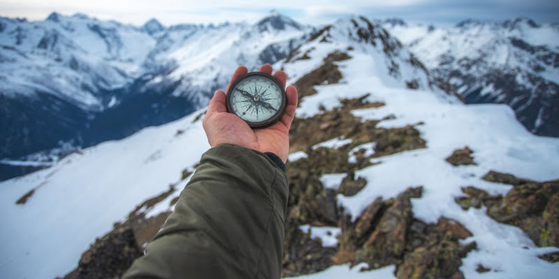
Using a compass while hiking is a crucial skill that helps you navigate and stay oriented in the wilderness. Unlike GPS devices, a compass doesn’t need batteries or signal reception, making it a dependable tool for outdoor adventurers. This guide offers step-by-step instructions to help you use a compass effectively during your hikes. We hope this guide will help you master your new compass with precision.
How to Use a Hiking Compass Hiking
Let’s see how to use a compass while hiking step by step…
Presentation of the device
When hiking, your compass is an essential tool for orientation, with the well-known red needle that points to the North. Besides this, on your plate compass, you’ll find:
- A measurement scale adapted to maps with 1:25,000 or 1:50,000 scales
- A sighting arrow
- A rotating compass dial
These features will help you make full use of your compass and navigate your way with ease.
The different uses of the compass
Let’s see 3 different uses of the compass while hiking…
1. The classic use: orient your map
The most common and straightforward use of a compass is to orient your map and determine the direction you need to go. Since all maps are oriented to the North, your compass will help you identify where the North is and properly align your map. To do this, lay your map flat, place the compass on it, and rotate the map until the North on the compass aligns with the North on the map. This will guide you in the right direction to reach your destination.
2. Triangulation: finding your way on a map
A lesser known but highly useful function of a compass, especially when you’re lost, is its ability to help you locate your position on a map using the triangulation method. This method can be a lifesaver in certain situations. To use it, you’ll need visible landmarks in the landscape that are easily identifiable on your map—such as a mountain peak, village, waterfall, or forest. For accurate results, you’ll need at least three distinct landmarks.
Once you’ve identified your landmarks, follow these steps for triangulation:
- Point the aiming arrow at the first landmark.
- Rotate the compass dial until the North on the dial aligns with the compass needle.
- Note the angle on the dial and prepare to transfer it to your map.
- Repeat the process for the other two landmarks.
After determining the three angles, transfer them onto your map:
- Set the compass dial to the first measured angle.
- Align the aiming arrow with the landmark on the map, ensuring the North on the map matches the North on the compass dial.
- Draw a line starting from the reference point.
- Repeat this with the other two landmarks.
The intersection of the three lines on your map marks your exact location. This technique can be useful for reorienting yourself, especially when lost during a hike.
3. Heading: finding the most direct path to a given point
The last use of the compass is also unknown. It is the displacement of the heading that makes it possible to find the shortest way to go from point A to point B, without following a given path. This can be useful when you need to get straight to a point more quickly through a forest or a field without taking the usual trails. For this method, I will work in reverse triangulation. So, I have to know where I am on the map and where I want to go. To use this function with your compass, you will need:
- Draw with the edge of the compass the path you want to take from the starting point to the ending point.
- Rotate the compass dial until the North in the BaseMap matches the North of the compass dial.
- Read the angle on the compass. This angle is called Azimuth.
- Place the North hand in the North of the dial background.
- Follow the azimuth while walking. It shows you the most direct path from point A to point B.
While a compass is a reliable traditional navigation tool, many hikers also prefer modern digital tools like smart devices. You can explore the best smartwatch for hiking that includes GPS tracking, altitude, and route monitoring features.
You now know all the intricacies of using the compass and are armed to set off with your compass and your map without the risk of getting lost and even having the possibility to think outside the box!
Frequently Asked Questions:
Why should I use a compass instead of relying on GPS?
A compass is a reliable navigation tool that doesn’t depend on batteries, signal reception, or electronic functionality, making it useful in remote areas where GPS may not work. For hikers who want a hybrid solution combining navigation and fitness tracking, modern devices like GPS hiking smartwatches can be a great option.
Can I use a compass without a map?
Yes, you can use a compass to follow a set bearing or heading even without a map. However, combining it with a map allows for more precise navigation and positioning.
How do I maintain accuracy when using a compass?
To maintain accuracy, avoid using your compass near metal objects, electronics, or magnetic fields, as they can interfere with the needle’s function.
What is azimuth, and how do I use it with a compass?
Azimuth is the angle between your starting point and your destination. You can calculate it using the compass and follow that specific angle to reach your destination in the most direct path.
Is a compass useful in bad weather?
Yes, a compass remains functional in all weather conditions, unlike some electronic devices that may be affected by rain, cold, or low battery life. In addition to a compass, carrying basic safety gear such as emergency whistles for hiking can significantly improve your chances of being rescued if you get lost.
How do I adjust for magnetic declination when using a compass?
Magnetic declination is the difference between magnetic north and true north. Adjusting for declination ensures your compass readings match the map accurately. Check the declination value for your area (usually printed on topographic maps) and either manually add or subtract it when taking bearings. This step improves navigation precision, especially on longer hikes.
Can I use a compass at night or in low visibility?
Yes, a compass can be used in low-light conditions. Combine it with a headlamp or glow-in-the-dark compass markings for better visibility. While landmarks may be hard to see at night, a compass still allows you to follow a specific bearing or heading safely.